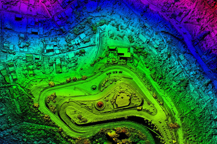
We are at the cusp of a geospatial artificial intelligence (AI) revolution. At its core, Geospatial AI is a discipline that combines innovations in spatial science and AI methods to extract knowledge from spatial big data, which encompasses any data related to the Earth’s surface. Astoundingly, the market of geospatial analytics is expected to grow at a CAGR of 24% between 2020-2025.
As the technology continues to develop at a record-breaking pace, one of the most important applications of Geospatial AI is to help mitigate and combat the effects of climate change and natural disasters. Data gathered through geospatial techniques on factors like flood levels, land surface temperatures, and wind speeds can provide vital insights to governments and local authorities. Such data allows these institutions to make preemptive decisions to preserve the environment and quickly respond to emergencies and even track, understand and predict the spread of pandemics like the present one.
Here are the top ways in which Geospatial AI can help fight climate change – and what we can expect for the future.
Geospatial AI helps ease the impact of natural disasters
The data extracted through Geospatial AI techniques can be invaluable to governments and NGO teams responding to natural disasters to best assess where to strategically allocate resources and how to protect human, animal life and infrastructure.
Facebook’s Data for Good Disaster Maps is a great example of this in action. The real-time data from these maps can inform initiatives including preparedness projects and vaccination campaigns. Local authorities and NGOs can use them to know what services and supplies communities need most in times of natural disaster, which communities have power and access to cellular networks, and which areas have already evacuated.
Another use case comes in the form of wildfire mapping. Scientists from Stanford University developed a deep-learning model that maps fuel moisture levels across 12 of the US’ Western states, making it easier to predict where wildfires are likely to ignite and spread.
And in Indian cities, where river and lake floods are commonplace, Geospatial AI has been used to analyze granular satellite data and predict which areas are vulnerable to flooding. These insights can even be as accurate as to indicate which buildings will be impacted and the water level at each block. This allows authorities and response teams to be as efficient as possible in allocating resources and mitigating extensive damage.
Geospatial gives predictive insights to drive action
In addition to helping governments prepare and address natural disasters, Geospatial AI is also helping scientists, governments, and public bodies make future macro predictions about the impact of climate change, spurring action to mitigate those effects.
For example, building urban resilience in partnership with Microsoft and Gramener, Evergreen has used open-source data, including satellite imagery, to predict where Urban Heat Islands are most likely to be in a city, at a micro-scale as small as a single rooftop. These insights can help governing bodies and city planners intervene to lower the temperature of those heat pockets, by creating policies on the planning or construction of buildings to keep higher temperatures under check. Over the years, these insights will eventually provide a rich data picture that allows local governments to generate scenarios and forecast future trends to make preemptive decisions to prevent localized overheating of areas in a city.
Another example of this in action comes from Microsoft AI for Earth partner SilviaTerra, a platform that combines satellite imagery with machine learning to survey forests across the US. The data gathered then helps governments, conservationists and landowners assess their forests and develop sustainable management plans – a process which was previously time and resource-intensive.
What’s ahead for Geospatial AI
In the near future, we can expect to see huge growth in the environmental applications of Geospatial AI. Some of the upcoming trends include the use of LiDAR imagery to map environments to power conservation efforts, or using drones to survey ecosystems such as construction sites, forests, and glaciers.
This won’t happen by accident, though – there needs to be an immense amount of data acquisition & inventory building, infrastructure that needs to be at the forefront of the Geospatial AI revolution. Technologists and scientists that understand the potential for this technology to do good must work to get stakeholders on board and to invest in these solutions. All market players need to work in tandem to democratize Geospatial AI and make it mainstream.
The Geospatial AI movement is evidently only in its infancy, especially when it comes to environmental applications. However, based on what we have seen so far, the technology holds huge promise to help us not only mitigate some of the worst effects of climate change after-the-fact, but also preemptively stop it from occurring in the first place.


