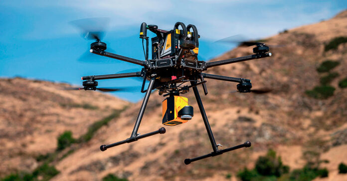
Drones, once mainly used by the military and photography enthusiasts, have become very useful in commercial sectors, especially in mapping. They can fly at different heights to take detailed aerial photos and collect data, which is vital for areas like city planning, farming, environmental monitoring, and infrastructure development. Drones make it easier, cheaper, and safer to gather spatial data compared to traditional ground surveys.
Drones offer more value in mapping than just efficiency. They capture images, detect illegal land use, assess disaster damage, and reach remote or dangerous areas, aiding in disaster response and wildlife conservation through drone mapping services. Their use in farming for precise crop monitoring highlights their versatility. Future improvements with AI and machine learning promise even greater accuracy and efficiency. This article highlights how drone technology enhances data accuracy and availability, driving innovation and better decision-making across various fields.
Table of contents
Benefits of Drones for Mapping
Focusing on the benefits of using drones for mapping, it’s clear they offer several advantages. Drones are great at collecting high-quality data from hard-to-reach places, like rugged terrains, hazardous areas, or environmentally sensitive zones. This ability to easily handle natural obstacles ensures more accurate data and significantly reduces the risks for human surveyors.
Additionally, drones are more economical than traditional methods. They eliminate the need for expensive ground equipment or large crews, resulting in timely and cost-effective data collection. This cost-effectiveness doesn’t compromise data quality; drones usually provide better quality images, enabling detailed and precise maps.
Detection of Encroachments
Drones are becoming essential for spotting land encroachments. By flying over the land, drones take aerial photos and create detailed maps that show unauthorized buildings or land misuse. This view from above helps reveal things that might be missed on the ground, such as small illegal structures or subtle land changes.
Drones can return to the same areas regularly to check for changes, helping authorities monitor and manage land use more easily. Advanced imaging technology allows drones to make high-resolution maps, giving clear and useful data for legal and environmental purposes. For instance, these maps can show precise boundaries, vegetation health, and erosion patterns. So, drones not only find encroachments but also help with ongoing land management and enforcement.
Mapping Natural Disasters
After natural disasters, drones are incredibly useful for quickly mapping damaged areas, which helps speed up and improve rescue and recovery efforts. They take high-resolution images and generate detailed maps, helping teams manage dangerous and hard-to-reach areas. This mapping is important for immediate response and for planning future disaster preparedness, allowing for accurate assessments of infrastructure damage and potential hazards.
Drones can quickly evaluate a situation and provide real-time information, essential for making informed decisions in managing disaster-affected areas. They can also deliver medical supplies, food, and water to isolated survivors.
Precision Agriculture
As the agricultural sector aims for more efficiency and sustainability, drones are becoming a must-have in precision farming. These flying devices are widely used to create detailed crop maps and monitor plant health, giving farmers important information to make better decisions about managing their crops. By examining aerial data, farmers can spot differences in crop health across their fields, allowing them to target specific areas and reduce the use of water, fertilizers, and pesticides.
This approach not only improves crop yields but also lessens the environmental impact of farming. Drones are at the forefront of modern farming techniques, combining advanced technology with eco-friendly practices, and are key for achieving a balance between high productivity and environmental care.
Future of Drone Mapping
The future of drone mapping looks highly promising, with advancements in artificial intelligence and machine learning set to significantly improve how data is analyzed and used. These technologies will help identify important details in vast amounts of images, enhancing accuracy and efficiency in fields like urban planning, agriculture, disaster management, and environmental conservation.
However, there are notable challenges. Regulations are constantly changing as policymakers try to keep up with rapid technological progress, balancing privacy, safety, and commercial interests. Ethical concerns about data collection and surveillance emphasize the need for responsible guidelines to ensure these tools benefit society as a whole.
Drones have revolutionized the mapping industry by offering an efficient, cost-effective, and safer alternative to traditional ground surveys. Their ability to access hard-to-reach and hazardous areas provides invaluable data for city planning, agriculture, environmental monitoring, and infrastructure development. Beyond capturing images, drones play a central role in detecting illegal land use, assessing disaster damage, and monitoring wildlife conservation. With advancements in AI and machine learning, the potential for increased accuracy and efficiency in drone mapping is immense. This transformative technology enhances decision-making across various sectors, driving innovation and sustainable development.


