
Growth has a knack for catching cities and regions by surprise. One moment, everything feels manageable. Next, traffic gets heavier, green spaces disappear, and facilities get overloaded. By 2050, it’s expected that 68% of the global population will live in cities, placing unprecedented pressure on land and resources. What has changed is not only the scale of this challenge, but the technology now available to address land use planning.
Digital planning tools, data platforms, and predictive technologies are enabling planners to anticipate issues before infrastructure fails or environmental damage occurs.
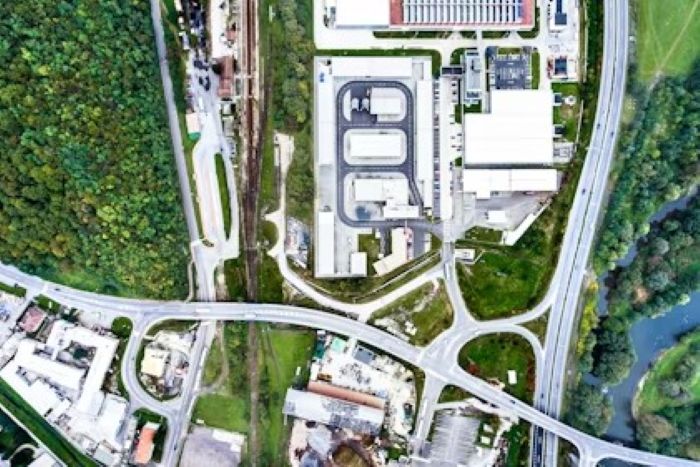
As populations grow and land becomes increasingly scarce, technology-driven planning systems are transforming decision-making, allowing communities to plan in a smarter, faster, and more sustainable way from the outset.
Key Takeaways
- Growth in cities surprises planners, leading to traffic and resource challenges, especially by 2050 when 68% will live in urban areas.
- Technology enhances land use planning by using digital tools and real-time data, making decision-making proactive and efficient.
- Sustainable growth relies on data for better planning, allowing for predictions on housing supply and environmental impact.
- Digital governance frameworks and collaborative tools foster transparency and participation in land use decisions, ensuring inclusivity and long-term benefits.
- Technology-driven land use planning addresses climate change by integrating data to reduce emissions and adapt infrastructure to risks.
Table of contents
- Understanding Technology’s Role in Land Use Planning and Sustainable Growth
- Digital Policies and Governance Frameworks for Smarter Land Use
- Climate Change and Technology: Enabled Land Use Resilience
- Urban and Rural Land Use in the Age of Digital Planning
- Case Studies and Global Best Practices in Digital Land Use Planning
- Where Digital Planning Meets Long-Term Impact
Understanding Technology’s Role in Land Use Planning and Sustainable Growth
Land use planning and sustainable growth have long been interconnected, but technology has fundamentally reshaped how this relationship works in practice. Digital systems now turn planning into a continuous, data-informed process rather than a one-time, static exercise.
Instead of relying on historic assumptions, planners increasingly use real-time data, digital modeling tools, and integrated platforms to adapt land use strategies as conditions change.
What Modern Land Use Planning Looks Like in a Digital World
Land use planning is no longer carried out with clipboards and static maps. Today, planners rely on GIS platforms, satellite imagery, cloud-based land management systems, and live data feeds to understand how land behaves over time.
These technologies surface risks, constraints, and opportunities early, enabling decision-makers to guide growth deliberately and proactively. As a result, costly challenges such as congestion, unchecked urban sprawl, or environmental degradation can be addressed long before they become entrenched.
Sustainable Growth: Enabled by Data, Not Guesswork
Sustainable growth is not about halting development or choosing between economic progress and environmental protection. Instead, it’s about making informed decisions backed by reliable data and digital analysis.
With the support of scenario modeling software and predictive analytics, planners can simulate multiple development paths, assess trade-offs, and understand long-term impacts before construction begins.
AI-driven modeling and forecasting tools are increasingly used to assess long-term land use impacts before development begins, helping planners evaluate infrastructure strain, environmental risk, and population growth with greater accuracy.
Where zoning changes once relied heavily on speculation, technology now allows planners to forecast outcomes related to housing supply, transport demand, emissions, and land degradation, ensuring sustainability decisions are driven by evidence rather than intuition.
Digital Policies and Governance Frameworks for Smarter Land Use

Even the most advanced technology has limited impact without strong governance. What has evolved is how land use policies are created, tested, and refined using digital tools.
Data-Driven Policies That Guide Sustainable Land Use
Zoning rules and land use regulations are increasingly shaped by integrated digital platforms that combine environmental data, population trends, land capability assessments, and economic indicators into a single planning environment.
LandTech, for instance, implements this methodology by providing planning aids, allowing a review of land through dependable, uniform data. Its detailed guide on agricultural land classification and its role in planning explains how exact classification the basis for food security, environmental protection, and long-term development can be, especially as the pressure of urban expansion on productive farmland increases.
Governance, Transparency, and Digital Collaboration
Technology has also reshaped collaboration between planning authorities. Cloud-based systems and shared digital workspaces allow local, regional, and national bodies to coordinate decisions, review proposals, and update policies regardless of physical location.
Public-facing digital tools further enhance transparency. Interactive maps, online planning portals, and visual modeling tools make proposals easier to understand, fostering trust, improving public engagement, and reducing friction during implementation.
Core Technology Principles Shaping Sustainable Land Use Decisions
Effective land use planning is a deliberate act, not an accidental one. Technology is a tremendous aid in improving the four core values that are fundamental to community development: efficiency, fairness, and environmental responsibility.
Smart Growth Powered by Digital Infrastructure
Smart growth focuses on using land more efficiently rather than expanding outward indefinitely. Digital planning technologies help identify where higher-density or mixed-use development is most viable, based on infrastructure capacity and demand patterns.
Transport modeling tools enable planners to align land use with mobility systems, reducing car dependency and associated emissions. When housing, employment, and transport are digitally coordinated, communities become more accessible, efficient, and desirable places to live.
Planning With Nature Through Environmental Technology
Environmental concerns now sit at the centre of land use decisions. Remote sensing, environmental modeling software, and geospatial analytics allow planners to assess flood risks, heat exposure, biodiversity corridors, and soil conditions before development begins.
This enables nature-positive planning, where wetlands are preserved, green spaces are protected, and green infrastructure is integrated to mitigate future risks while improving quality of life.
Equity and Inclusion Through Digital Participation
Land use decisions determine who will benefit from growth and who won’t. Technology is making planning more inclusive by reducing barriers to participation. Online engagement tools, interactive maps, and digital feedback platforms let more people have a say.
At the same time, demographic and socioeconomic datasets help planners identify historically underserved areas and design policies that address inequality rather than reinforce it.
Climate Change and Technology: Enabled Land Use Resilience

Climate change is no longer a future concern; it is a present reality. Technology-enabled land use planning plays a critical role in both emissions reduction and climate adaptation.
Reducing Emissions Through Smarter Spatial Decisions
Where and how buildings are constructed directly affects carbon output. Compact, data-informed development reduces transport emissions, while zoning supported by digital analysis can encourage renewable energy adoption and energy-efficient construction.
By using impact assessment tools and emissions modeling, planners can evaluate sustainability outcomes early, avoiding costly retrofits and long-term environmental damage.
Adapting Land Use to Climate Risks
Adaptation means lessening the risk exposure. Floodplain mapping, heat modeling, and climate data are some of the tools that help planners to prevent new developments in high-risk areas or to design climate-resilient infrastructure in case of unavoidable development.
By foreseeing the danger, urban planners can reduce future damage, safeguard the most vulnerable, and not bear the high cost of recovery.
Urban and Rural Land Use in the Age of Digital Planning
Urban and rural areas experience different kinds of problems; however, they both benefit from better data and smarter tools.

Managing Urban Growth Without Losing Livability
Cities must accommodate growth without overwhelming infrastructure or eroding quality of life. Digital zoning tools, density modeling, and transport simulations help planners understand infrastructure limits before they are exceeded.
Aligning land use decisions with transportation and public services will result in cities that are more efficient, less crowded, and offer a better quality of life.
Protecting Agricultural Land Through Precision Planning
Rural lands are instrumental in the supply of food, supporting people’s livelihoods and maintaining healthy ecosystems. Precision planning technologies enable accurate identification of prime agricultural land and environmentally sensitive areas.
With reliable, time-based land data, planners can guide development away from critical farmland, balancing growth with long-term environmental and food security goals.
Challenges and Opportunities in Technology-Driven Land Use Planning
Even the strongest strategies face real-world constraints. While technology cannot eliminate every challenge, it fundamentally changes how those challenges are addressed.
Land Scarcity, Degradation, and Digital Innovation
Improper land management is the main cause of degradation and scarcity of land. Now, we can monitor how land condition changes with the help of satellites, gather data with analytics tools, and thus locate the areas where there are signs of problems waiting to be unlocked and carry out the necessary activities well before the damage becomes irreparable.
Land is no longer treated as a static asset; digital monitoring transforms it into a dynamic resource that can be actively managed and protected.
Balancing Development Pressure with Long-Term Protection
Economic growth and environmental protection are often seen as opposing forces. Scenario modeling tools help reconcile these priorities by visualising the long-term outcomes of different choices.
When decisions are grounded in data rather than debate alone, it becomes easier to align development with conservation.
Case Studies and Global Best Practices in Digital Land Use Planning
Real-world examples demonstrate how technology-enabled land use planning supports strategic objectives across diverse regions.
What Successful Technology-Enabled Planning Looks Like
Whether it’s a city using digital zoning platforms to promote mixed-use development or a rural region leveraging satellite data to protect farmland, successful initiatives share common traits.
They’re based on reliable data, coordinated policies, community involvement from the outset, and continuous monitoring, all stages being facilitated by technology.
Innovation and the Future of Land Use Planning
Computing with the aid of GIS, AI, and techniques like predictive modeling is quickening processes associated with land use decisions.
Such processes help to carry out isolated tests of scenarios, warn about the coming of dangers, and increase the degree of openness, in such a way that local authorities gain a nimbler reaction to the issues brought by a larger population and changes in the environment.
Where Digital Planning Meets Long-Term Impact
Land use patterns are usually planned to influence the future in a way that their consequences aren’t visible initially. Technology increases both the responsibility and the opportunity to plan wisely.
When planning is based on data and supported with long-term thinking, it can be a lever for growing the economy, saving nature, and spreading the benefits of development.
Bad choices lead to even greater costs in the future. Smart, technology-led planning delivers compounding benefits. In a nutshell, sustainable development isn’t a matter of luck; it’s the result of careful planning.
")


